Topic: Integrated river basin management - International Riversymposium
17300
page-template,page-template-full_width,page-template-full_width-php,page,page-id-17300,page-child,parent-pageid-17640,bridge-core-1.0.6,,qode_grid_1200,footer_responsive_adv,qode-child-theme-ver-18.2,qode-theme-ver-18.2,qode-theme-riversymposium,qode_header_in_grid,wpb-js-composer js-comp-ver-7.6,vc_responsive
 

Topic: Integrated river basin management

Jump to:

Future Cards – Tools for Integrated River Basin Management
Heath Kelsey, Simon Costanzo (presenter), Andrea Abassi, Sarah Freeman and Louise Gallagher
University of Maryland Center for Environmental Science, USA

Developing river basin report cards: A practitioner’s guide
William Dennison, R. Heath Kelsey and Michele Thieme
University of Maryland Center for Environmental Science, USA

The story of the Thames – from liquid history to solid future
Alastair Driver
Environment Agency, UK

Long term managament of a rapidly aggrading alluvial river in New Zealand
Matthew Gardner
Land River Sea Consulting Ltd, New Zealand

Development of river basin models for investigation of improved water management options: case study of the Upper Godavari basin in India
Dr Avinash Garudkar, Channawir Birajdar, Dr Carl Daamen, Er Karina Redpath and Dr Robert Carr
Water and Land Management Institute (WALMI) and eWater

Restoring river system processes at the catchment scale for economic and social resilience
David Hetherington, Paul Quinn and Alex Nicholson
Arup, United Kingdom

Supporting integrated water resources management in the Koshi Basin, and beyond
Dave Penton, Luis Neumann, Tanya Doody, Tira Foran, Susan Cuddy and Hongxing Zhen
CSIRO, Australia

Water use and agricultural production trends in the Indus basin: Implications for future food security
Mobin-ud-Din Ahmad, Mac Kirby and Geoff Podger (presenter)
CSIRO, Australia

Risk assessment for developing sustainable catchment management practices in Badulu Oya Upper Watershed, Sri Lanka
Chathura Sanjeewa, Ruwan Liyanage, Manjula Wijekoon and Prasanna Pradeep
National Water Supply & Drainage Board, Sri Lanka

The Rhine and its water quality
Tabea Stötter
International commission for the protection of the Rhine, Germany

Water insecurity and IWRM in West Timor, Indonesia
Mark Wolfsbauer
Even Flow Consultant Services, Australia

Monday 12 September
10:30 – 12:00

Development of river basin models for investigation of improved water management options: case study of the Upper Godavari basin in India

Dr Avinash Garudkar, Channawir Birajdar, Dr Carl Daamen, Er Karina Redpath and Dr Robert Carr
Water and Land Management Institute (WALMI), Global

Equitable distribution of water is contemplated in the State Water Policy of Maharashtra. The state of Maharashtra has also formulated the law for implementation of equitable distribution of water. However, since equitable distribution has many dimensions, its implementation in river basins has been difficult. There is a demand from stakeholders that both distress and water be equitably shared in the basin and this is leading to frequent confrontations amongst upstream and downstream beneficiaries.

The Government of Maharashtra noticed that the situation in the Godavari basin is similar to situation of Murray Darling Basin in Australia and hence a Schedule for ‘Actions to Improve River Basin Management’ was agreed in August 2014 under an MOU between the Government of Maharashtra, India and the Government of New South Wales, Australia. Under this Schedule a joint project team was formed to build river basin models for the Upper Godavari and to exchange experience and knowledge in water management.

For the purposes of the project the Upper Godavari basin is divided into smaller sub-basins. At present, a river basin model for the Mula-Pravara sub-basin has been built using the eWater Source modelling platform to demonstrate use of Australian tools relevant to investigation of water management issues in Maharashtra. Construction of a larger model of the whole Upper Godavari is progressing well and it will be used to compare the effects of new water management options on basin water use. This will provide important information to support development of new water management policies for this basin.
This paper summarises the aims of the project and presents some preliminary model results. It will also demonstrate how the model platform can be used to fill in gaps in the available data sets and therefore help to generate a full picture of basin water balance.

About the author

Dr Avinash Garudkar is Professor and Head in Water and Land Management Institute (WALMI), Water Resources Department, Government of Maharashtra. He is a graduate in Civil Engineering with Masters Degree in Hydrology from IIT Roorkee and PhD from IIT Bombay. He has 15 years field & 10 years teaching experience, has published 18 Papers and received a gold medal for Best Journal Paper of Institution of Engineers India in 2012 and also conferred with “Eminent Engineer Award” in 1997 and “Outstanding Engineer Award” in 2011 by The Institution of Engineers (India), Mumbai. •He is visiting faculty to various Institutions in the country and abroad and was invited as an Expert Panelist in India Water Week 2013 and co-chairman in India Water Week 2016. Presently he is involved in IWRM of Upper Godavari Basin Project in Collaboration with eWater New South Wales, Australia.

Water use and agricultural production trends in the Indus basin: Implications for future food security and their significance to environmental flows

Mobin-ud-Din Ahmad, Mac Kirby and Geoff Podger
CSIRO, Australia

The Indus basin is one of the world’s major food baskets. Its agriculture feeds about 250 million people who live in the basin in Pakistan, India and Afghanistan. Most of the agricultural activities are concentrated in the Indus plains which have a semi-arid climate. The area is predominantly under irrigated agriculture which has expanded greatly over the past five decades enhancing agricultural production to meet food and fibre demands. However, one of the key drivers for the expansion is a massive increase in groundwater use for irrigation. As a result, in areas of fresh groundwater quality, almost half of the irrigation supplies come from groundwater.

Groundwater use today is very likely unsustainable in the areas of heavy use. And yet, with the population set to increase by at least another 100 million by 2050, the use of groundwater may greatly increase. Thus, the increasing reliance on groundwater to meet future demand poses a series concern for sustainability of groundwater resource and irrigated agriculture.

We describe the current state of water resources and cropping systems in the Indus plains in India and Pakistan. With particular focus on the Indus basin irrigation system in Pakistan, we explore the detailed interactions of food availability, water availability and use, and the increasing population, in terms of both past trends and future projections. The analysis reveals that, at least in the short to medium term, increasing and unsustainable groundwater use is probably unavoidable. In the longer term, food security for Pakistan with sustainable use of the available water resource will require some mix of: enhanced surface water storage (building more dams); changing crop mix with capping the area of high water use crops; radically boosting crop yields, presumably through research and development of crops and crop management; and importing more food.

About the author

Dr Mobin-ud-Din Ahmad is a Research Scientist in CSIRO Land and Water and has over 20 years of international research experience on broad range of issues related to land and water. Currently he is leading an Australian Government funded Indus SDIP project that aims to build integrated water resources management modelling capacity within Pakistan. This work will provide a comprehensive strategic assessment of the Indus water resource, and a framework for making regional trade-off decisions and providing for operational efficiencies in water use and sharing in Pakistan.

Water insecurity and IWRM in West Timor, Indonesia

Mark Wolfsbauer
Even Flow Consultant Services, Australia

West Timor is a semi-arid region in east Indonesia. The region is located within the province of Nusa Tenggara Timor, one of the poorest provinces in the country. The region’s population is predominantly rural and dependent on rainfed irrigation. The El Nino-related drought of 2015/2016 has exposed the vulnerabilities of the rural population, with over 180,000 people requiring government food aid to cope with the drought. This paper examines water insecurity in West Timor, assesses the water resource governance arrangements and describes the current strategies being pursued to improve the capacity of rural communities to cope with drought.

About the author

Mark Wolfsbauer is a water and sanitation consultant with experience working in Africa, Asia and the Pacific. His professional interests concern the effective delivery of humanitarian aid and the design and evaluation of sustainable water, sanitation and hygiene (WASH) services. His presentation is based on his work with Action Against Hunger in Kupang, Indonesia and research conducted for the purposes of a Masters in Integrated Water Management with the International Water Centre in Brisbane, Australia. Mark has a strong interest in the sustainable management of water resources and hopes that this presentation will help fill data gaps concerning the situation in West Timor.

Tuesday 13 September
15:30 – 17:00

Developing river basin report cards: A practitioner’s guide

William Dennison, R. Heath Kelsey and Michele Thieme
University of Maryland Center for Environmental Science, USA

We have been developing river basin report cards for over fifteen years on several continents and would like to impart our experience and expertise to other groups interested in this environmental management tool. As part of a partnership between WWF and the University of Maryland Center for Environmental Science, we have developed a Basin Report Card Initiative. In this initiative, we have the ambitious goal of empowering local and regional bodies to develop river basin report cards globally. To help achieve this goal, we produced a guide book to assist groups who want to produce report cards using a step by step approach. Our emphasis in on examples and lessons learned using extensive color graphics.

In the ‘Why do a report card?’ chapter, we provide a rationale to resource managers, scientists and policy makers for producing report cards. We also illustrate benefits of the report card process. In the ‘What makes a good report card?’ chapter, we identify key report card attributes, discuss the report card process, and stress the importance of linking to recommendations on how to improve report card scores. In the ‘Getting started’ chapter we introduce the enabling conditions and funding considerations, discuss staffing needs and institutional commitments, lay out the logistics, timeline and milestones, and argue for setting up an evaluation strategy. In the ‘Creating a report card’ chapter, we go through the five step process: 1) conceptualization, 2) choosing indicators, 3) defining thresholds, 4) calculating scorecards and 5) communicating results. In the ‘Using a report card’ chapter, we address the development of a narrative, keeping stakeholders engaged, building a communication strategy and catalyzing management actions. In the ‘Overcoming challenges’ chapter, we use case studies and lessons learned to illustrate examples of overcoming barriers.

About the author

Professor Bill Dennison is Vice President for Science Applications at the University of Maryland Center for Environmental Science (UMCES). Bill leads the Integration and Application Network (IAN), a collection of scientists interested in solving, not just studying environmental problems. IAN is a collection of Science Integrators and Science Communicators that work closely with various agencies, foundations and non-government organizations to develop integrated science products using principles of effective science communication. Bill was involved for ten years with the Healthy Waterways program in Queensland, Australia. He joined UMCES in 2002 and is involved in the Chesapeake Bay Program, currently serving as the inaugural co-chair of the Science and Technical Assessment & Reporting group. Bill and his team of Science Integrators and Science Communicators have pioneering novel science communication techniques including an online conceptual diagram creator using the IAN symbol library. The IAN team produces a suite of environmental report cards globally.

Risk assessment for developing sustainable catchment management practices in Badulu Oya Upper Watershed, Sri Lanka

Chathura Sanjeewa, Ruwan Liyanage, Manjula Wijekoon and Prasanna Pradeep
National Water Supply & Drainage Board, Sri Lanka

The World Health Organization (WHO) has identified, inadequate access to safe drinking water and sanitation as a leading cause of disease and death around the world. Though Sri Lankan population has a relatively good access to improved water supply and sanitation, health problems caused due to unsafe portable water have been increased over time in Sri Lanka as well. Most of these illnesses and deaths can be prevented through simple, inexpensive measures. The WHO guidelines for drinking-water quality, aim to protect public health through the adoption for a water safety plan. Catchment protection is a foremost fact in water management and safety plans since human activities in the catchment area can lead to water pollution and negatively impact public health. Proper watershed management could decrease the spreading of water borne diseases which saves money for medication and forms a healthy community. This study was conducted to assess the catchment area of Badulu oya which is the main water source in Badulla district, Sri Lanka. Watershed boundary was demarcated. Land use map, elevation model and the slope distribution of the catchment area were developed by using ArcGIS 10.1. Risk analysis was done by using weighted overlay analysis in ArcGIS 10.1. Meteorological data were analyzed. The risk analysis highlighted that the slope stability, unsafe sanitation and hygiene practices adopted by the people and improper waste disposal are the main issues in the watershed. Soil erosion is a serious concern since it deteriorates the quality of stream water by increasing turbidity. Moreover, Sediment attached pollutants also can be transported to the water. Awareness creation, adoption of soil conservation measures and strict implementation of laws and regulations are recommended to sustainable management of the watershed.

About the author

Chathura Sanjeewa is from Badulla, Sri Lanka and works as a Civil and Environmental Engineer for the National Water Supply and Drainage Board, the governmental organization responsible for water supply and drainage in Sri Lanka. She continues studying and researching in sustainability, environment, water and energy, and believes in continuous improvement within the working environment and professional career. She has completed the Master’s degree in Integrated Water Resources Management at University of Peradeniya, Sri Lanka, and was the Editor for the Institute of Engineers Sri Lanka-Uva Chapter.

The Rhine and its water quality

Tabea Stötter
International commission for the protection of the Rhine, Germany

The Rhine, one of the largest rivers in Europe, has undergone a history of tremendous pollution and impressive restoration. A fire at Sandoz in Basel in 1986 caused the death of all aquatic life for up to 400 km downstream. This changed the discussions to a more long term ambitious goal setting and programmes against pollution and for restoration were launched. In the International Commission for the Protection of the Rhine (ICPR) the nine states in the river catchment and the European Commission cooperate in order to harmonize the many interests of use and protection in the Rhine area.

The launched programmes are a success story, as pollution could be reduced and even the salmon, a lost migratory species, is coming back to the Rhine. Today water quality is much better again but we are facing new challenges. Wastewater contains a diverse group of micropollutants, which are partly not eliminated in the wastewater treatment plants. Very low quantities of these pollutants are detectable in waters and may detrimentally affect life in the Rhine and drinking water production.
The conference of Rhine ministers 2007 assigned the ICPR to develop a joint and comprehensive strategy for reducing and avoiding micropollutant inputs from urban wastewater and other (diffuse) sources into the Rhine and its tributaries by improving knowledge on emissions, eco-toxicological reactions in nature and to draft suitable treatment methods.

In addition to the pollution of water, the contamination of biota is a topic the ICPR is concerned with. Last year a pilot programme for measuring the pollutant contamination of biota was performed and will be analysed this year, including substances like industrial chemicals and plant protecting agents. Following the pilot programme, a regular measuring programme will start in 2018.

About the author

Tabea Stötter is working for the International Commission for the Protection of the Rhine (ICPR). She has a PhD in Climate Sciences from the University of Bern and a MSc in Environmental Geosciences from the University of Basel. In the ICPR she supports the working groups dealing with water quality and emissions. Beside the general monitoring and warning systems these working groups of the ICPR are concerned with micropollutants, new ways of detection and contamination of biota.

Long term managament of a rapidly aggrading alluvial river in New Zealand

Matthew Gardner
Land River Sea Consulting Ltd, New Zealand

The Waiho River is situated in the West Coast of the South Island of New Zealand.  The river is a steep, bed load dominated river, flowing from the base of one of the most popular glaciers on the New Zealand tourist trail.  The river flows adjacent to the Franz Josef Township, however, due to the fact that the bed level has been steadily aggrading over the past century the river bed is now perched significantly higher than the township.  The river is situated on a natural alluvial fan, however is constrained to its present alignment due to the location of its stopbanks, which are protecting the town as well as the State Highway.  In March 2016 the river broke through one of its banks destroying a hotel and threatened a popular campsite.  Fortunately, there were no casualties due to the efficient actions of local Civil Defence and Emergency Management staff however there is now a high risk that the river will avulse into the neighbouring Tatare stream with highly unpredictable consequences, putting the future of the Franz Josef Township at risk.

This presentation will look at the history of the management of the river; examine recent behaviour, as well as discuss the science behind the ongoing bed aggradation and potential options available to reverse the trend.  The presentation will also look at the innovative use of tools such as consumer grade drones to gain a better understanding of the catchment.

About the author

Matthew Gardner is the director of Land River Sea Consulting Limited, a small engineering consulting firm based in Christchurch, New Zealand which specialises in the hydraulic modelling of rivers and general river engineering. Matthew has experience working for large multinational consulting firms as well as for local government agencies in New Zealand. Matthew now provides technical services to a number of Local Government bodies around New Zealand as well as for private clients. One of his current clients is the West Coast Regional Council who has contracted him to help devise a short term as well as long term management strategy for the Waiho River.

Wednesday 14 September
08:30 – 10:00

The story of the Thames – from liquid history to solid future

Alastair Driver
Environment Agency, UK

The River Thames is the UK’s second largest river at 294 kms long and the catchment covers 16,000 km², with a dense population of 13 million people. This iconic river flows from the green rural upper reaches of the Cotswolds, through the large urban centres of Oxford, Reading and the UK’s capital’s city, London, on through the industrial heartland of Essex and Kent, and thus to the North Sea.

Pollution of the tidal Thames left the inner estuary biologically dead in the 1950s, but since then the river has been transformed into a thriving ecosystem teeming with fish, and with returning sea trout and otter populations.
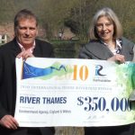
The Thames won the International Thiess Riverprize in Oct 2010 at the International Riversymposium in Perth, Western Australia. The bid was submitted by The Environment Agency, but reflected the work of thousands of people from hundreds of organisations over many decades. (The Agency donated the $350,000 prize money to the Thames River Restoration Trust, to establish a twinning project with the Yamuna River in India).

However, the population of SE England continues to rise and the associated development pressures remain significant, despite ongoing improvements in planning policy. In addition, sea levels are rising fast on the east coast of England and the climate continues to warm up, leading to more frequent and extreme weather events, especially flooding. As a result the Environment Agency and it many partners cannot rest on their laurels and there is huge ongoing investment in a multitude of solutions to ensure that a healthy Thames catchment is sustained for the benefit of people and wildlife. This presentation focusses on flagship examples of integrated solutions implemented on the ground since 2010, ranging from natural flood management in headstreams tthrough floodplain restoration and urban SuDS to coastal realignment in the Thames estuary.

About the author

Alastair Driver has the honour of inclusion in “Who’s Who” for distinction and influence in the field of environmental conservation and has a rapidly growing international reputation in the field of catchment management. He became the first Conservation Officer for the Thames in 1984, a role that he held for 18 years and since 2002 he has headed up the national biodiversity team for the Environment Agency in the UK. He holds many voluntary and advisory roles for national and international environmental organisations, including Ambassador for the International RiverFoundation, Trustee of the Wildfowl and Wetlands Trust and Panel Advisor for the National Trust. He is also Honorary Professor for Applied Environmental Management at the University of Exeter and a Fellow of the Chartered Institute of Ecology and Environmental Management. The personal highlight of his career was receiving the 2010 International Riverprize for the Thames.

Supporting integrated water resources management in the Koshi Basin, and beyond

Dave Penton, Luis Neumann, Tanya Doody, Tira Foran, Susan Cuddy and Hongxing Zhen
CSIRO, Australia

Through its own water reform journey, Australia has learnt many water management lessons that are universally applicable. These include the need to have agreement on the amount of water that is available, the demands that are made on it, and how it can be best shared to ensure that the livelihoods of the people and ecosystems that it supports are sustained. The Sustainable Development Investment Portfolio (SDIP) is an Australian government initiative with the goal of increasing water, food and energy security in South Asia, targetting the poorest and most vulnerable, particularly women and girls. Through SDIP, CSIRO is working with Nepali organisations that are responsible for their own water reform journey, with the aim to assist in building the evidence base necessary to guide strategic investments in water resources development.

A key target sector is water resources management. CSIRO has supported revisions to rainfall station locations, development of new gridded rainfall products and refinement of hydrological models, all of which lead to better understanding of the timing and availability of water in major streams, including under projected changes to climate.

We are working with local researchers to value-add on existing analyses of a) household livelihood strategies in the Koshi basin and b) links between stream-flow and ecology in Nepal. Nepali scientists have a deep understanding of how water moving through rivers and wetlands supports ecological species (e.g. birds, fish, macro-invertebrates), that is the river flow-ecology relationship. We are working with them to systematise this knowledge. The key benefit of understanding river flow-ecology relationships is that, when river flow changes occur, evidence is available to understand the likely impact on the ecosystems and livelihoods that it supports.

About the author

Mr. Dave Penton works for CSIRO Land and Water as the Research Team Leader for Integrated Basin Analysis and project leader for the CSIRO Sustainable Development Investment Portfolio – Koshi Project. He has over 10 years experience in the development of software and models for river basin planning applications.

Future Cards – Tools for Integrated River Basin Management

Simon Costanzo, Heath Kelsey, Andrea Abassi, Sarah Freeman and Louise Gallagher
University of Maryland Center for Environmental Science, USA

Ecosystem health report cards are proven tools for evaluating ecosystem health, communicating key results to broad audiences, and tracking progress toward restoration goals. Initial report cards focused exclusively on ecosystem condition, but are evolving to include pressures and management response, and are becoming multi-dimensional assessments that include a host of human elements including social, economic, and health-related components that are useful in supporting Integrated River Basin Management. A key element of report card messaging includes a “What you can do” section that suggests activities that stakeholders can do to improve conditions. This is an important awareness and educational tool, but recommendations on how to improve system status are limited to a basic understanding of the connections between indicators and ecosystem function. The need remains to quantify the integrated effects that specific actions can have on ecosystem health and thus the report card results.

We propose a new stakeholder driven component to the report card development process that uses system dynamics modeling to improve understanding of linkages between indicators and the ecosystem components that they represent. This can provide recommendations to improve status that are more rigorously derived, and estimate report card results based on various future interventions and events. Introducing this process early in report card development can assist in the selection of the most useful indicators and desired conditions. Stakeholders actively participate in the creation of a Causal Loop Diagram that explicitly represents the causal relationships between social, economic, and environmental indicators. Continued stakeholder participation is used to develop a quantitative Systems Dynamics model from the Causal Loop Diagram. Together, these elements are useful in quantifying intervention impacts and improving scenario planning that integrates across sectors. This approach stimulates multilateral dialogues, highlights connections across multiple sectors, and creates quantitative future report card results (Future Cards).

About the author

Dr. Heath Kelsey is the Program Director for the IAN group and oversees project management, communication coordination and data analysis. Dr. Kelsey has developed ecosystem health report cards in Chesapeake Bay, Mississippi River, Australia, and India, and has facilitated the development of standard indicators and methods for local watershed organizations in the mid-Atlantic. Dr. Kelsey’s research specialties include Science Communication, Indicator Development, Environmental and Public Health Assessment, Science in Policy, Coastal Zone Management, Pollution Indicators, Bacterial Source Tracking, Land Use and Nonpoint Source Pollution, Geographic Information Systems, Remote Sensing, Hydrology, and International Development. Dr. Kelsey obtained his academic training from St. Mary’s College of Maryland (B.A.), and the University of South Carolina (MSPH and PhD).

Restoring river system processes at the catchment scale for economic and social resilience

David Hetherington, Paul Quinn and Alex Nicholson
Arup, United Kingdom

Large areas of our landscape have been greatly altered after centuries of human activity across the globe. Such changes include deforestation, increased land drainage, surface mining, the straightening and embanking of rivers, the dewatering of wetlands and, critically, the establishment of intensive agricultural practices. In natural catchment systems (before human intervention) densely vegetated areas with deep absorbent soils catch and hold rainwater where it can slowly seep through the land and recharge groundwater reserves. Artificial changes have stripped away many of the natural environmental and ecological systems that have evolved and now ‘drain’ and degrade our catchments, increasing pollution, erosion and sediment transport, and flood and drought risk. This has resulted in an unsustainable landscape that does not work economically for society. A prime example of this is this is recent national press articles have suggested that there may only be 100 harvests left in the UK if current intense agricultural practices, and the associated degradation of soils, prevail.

This paper explains how the principals of Natural Flood Management (NFM) and ‘Catchment Process Restoration’ can be used to restore delivery rates of water and sediment towards more natural levels through reduction of sediment transport potential from flows, and through filtering and locking away of sediments in upland areas through improved land management practices. Such approaches result in a more sustainable situation that delivers a whole swathe of ecosystem services benefits such as increased food production, improved biodiversity, improved aesthetics and property values, infrastructure resilience and climate change mitigation and adaptation. Together, these benefits ultimately lead to economic and societal resilience, which is increasingly important as the global population increases and becomes increasingly concentrated in urbanised locations.
Examples will be given from numerous catchments in the UK and elsewhere in the world.

About the author

David is Water Research Manager for Arup and an experienced fluvial geomorphologist and catchment scientist. David has undertaken numerous investigations relating to the improvement and restoration of fluvial and catchment systems. David has a PhD in Fluvial systems and remote sensing and holds a Visiting Research Associate position in the Civil Engineering department of Newcastle University. David is a Fellow of the Royal Geographical Society and a Chartered Water and Environmental Manager, Scientist, Environmentalist and Geographer & has international experience of working in 15 different countries.