Topic: Technology and Innovation - International River Symposium
17343
page-template,page-template-full_width,page-template-full_width-php,page,page-id-17343,page-child,parent-pageid-17640,bridge-core-1.0.6,,qode_grid_1200,footer_responsive_adv,qode-child-theme-ver-18.2,qode-theme-ver-18.2,qode-theme-riversymposium,qode_header_in_grid,wpb-js-composer js-comp-ver-7.6,vc_responsive
 

Topic: Technology and Innovation

Jump to:

A framework for Ecological Transformation of Musi River through Geodesign
Ajitkumar Babar and Sarat Chandra Bokka (presenter)
ESRI India Technologies, India

Hydromorphological walkover survey of 5500km of Scottish Rivers: lessons and opportunities
Sally German, Katie Atkinson, Irantzu Lexartza and David Hetherington
Arup, UK

Riverbed Farming Technology adoption by land poor farmers of Tarai districts of Nepal
Hari Gurung and Juerg Merz
HELVETAS Swiss Intercooperation, Nepal

It’s more than just introducing technology: water resources data and information management systems in a post-conflict country
Craig McVeigh, Lucy Barton and Adam Smith
Similie, Australia

Monitoring River Ecosystems Through Citizen Science and Digital Tools
Dr. Pradeep Mehta, Surbhi Sharma, Surabhi Bhardwaj, Pranab J. Patar and Raghuvansh Saxena
Earthwatch Institute India

Modelling a part of Baitarani sub-basin using river system approach through source software
Rabindra Nath Sankhua, Rajendra Kumar Jain, Sandeep Bisht and Shikha Deep
Central Water Commission, India

Nanotechnology for Water Treatment
Jack Schubert
Murdoch University, Australia

Water Sensitive Growth, Not Water Intensive Growth in the North-Western Indian States
Ranvir Singh
Massey University, New Zealand

Assessing a varying demand scenario using WEAP for Damanganga Project, India
Sanjay Yadav and Minal Jariwala
Sardar Vallabhai National Institute of Technology, India

Managing Nutrients from Sewage Treatment Plant Discharges in to Receiving Waters by Utilising Nutrient Offsets Framework
Partha Susarla
Unitywater, Australia

Tuesday 13 September
08:30 – 10:00

It’s more than just introducing technology: water resources data and information management systems in a post-conflict country

Craig McVeigh, Lucy Barton and Adam Smith
Similie, Australia

Water resources data and information management for any nation is challenging. For post-conflict countries this challenge is great as historical records are often missing and data management processes are non-existent, new or uncoordinated. Under these conditions, national governments often have limited resources, experience, capacity, or initiative to develop the systems required to manage the national data and information.

Without a central authoritative repository of all water resources data and information, water resources activities risk duplication, opportunities are missed to build on established knowledge, ineffective water management decisions are made, and the achievement of national and international commitments in the WASH sector, such as the SDG’s 2030, are more difficult to measure.

Timor-Leste, one of the world’s newest nations, experiences many of these challenges as its water resources sector evolves. Recently a data and information management system, SIDJRI, was created to overcome these issues and assist future implementation of a Water Resources Management Law and Policy.

SIDJRI is a purpose built system that focuses on the user experience, applying e-learning inspired user interfaces designed for Timor-Leste to give the target users, who have limited database experience and technical knowledge, a non-technical and non-confronting experience. SIDJRI uses iconography and other visual queues, repeats processes to maintain familiarity, and improves accessibility through a multi-language interface.

SIDJRI manages data and information from meteorological, surface and groundwater monitoring stations, including, flow data, water borehole geological logs, and pump tests; water chemistry; water abstraction meter readings; and, a register of water boreholes and of water licences.

SIDJRI’s success results from the technologically driven solutions that focus on the interaction between Government staff and their workflows. The development of standard operating procedures for data collection, entry, storage and output, coupled with practical training, has created a more complete solution for managing Timor-Leste’s water resources.

About the author

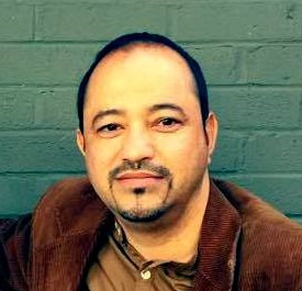
Craig, is co-founder of Similie, a boutique human development consulting firm that specialises in discovering innovative solutions through technology and human resources. By utilising e-learning and change management approaches, Similie has recently completed data and information management systems for water resources (SIDJRI), a public water supply system and community managers register (PWSCR) and agro-meteorology (AGROMET) for the Government of Timor-Leste. Craig has worked in the water resources sector for 18 years in Australia, Brazil and Timor-Leste, in primary research, program management, policy assessment, water planning and in advisory roles. Most recently Craig was the Water Resources Management Adviser to the Government of Timor-Leste for the Australian Government funded BESIK Program, where he delivered the National Water Resources Policy and Law, collaborated on the National Policy on Public Water Supply, undertook groundwater exploration programs and established SIDJRI to support water resources management. Previously Craig worked at the Australian National Water Commission.

Water Sensitive Growth, Not Water Intensive Growth in the North-Western Indian States

Ranvir Singh
Massey University, New Zealand

India is witnessing a rapid growth in its urbanisation, industrialisation and primary production sectors. This impressive growth is putting increasing pressure on the limited land and water resources available, particularly in North Western India. Groundwater resources are depleting at an alarming rate, particularly in the North-Western Indian States of Haryana and Punjab. In the year 2013-14, India produced about 103 million MT of rice and 92 million MT of wheat. About 9.56 million MT of rice and 3.77 million MT of wheat were exported, mainly procured the states of Haryana, Punjab, Uttar Pradesh and Madhya Pradesh. Considering the intense use of water use at around 2000 litres per kg for rice production and 700 litres per kg for wheat production, the current level of rice and wheat exports from India equates to an export of about 90 cm of groundwater level over the whole area of Haryana and Punjab combined. This region, particularly the districts of Punjab, Haryana, western Uttar Pradesh, needs a water sensitive growth, not a water intensive growth approach as they are currently exporting phenomenal amounts of virtual ‘embedded’ water in terms of wheat, rice and sugar leading to the depletion and contamination of groundwater resources. Reflecting on the challenges faced this paper focus on recent advances in concepts, technology and tools to improve land and water resource management. In particular, case study examples will be presented (i) to evaluate and improve performance of irrigation systems in northern India, (ii) for water resource planning and management in Western Sydney Australia, and (iii) development of precision ‘variable’ rate irrigation in New Zealand.

About the author

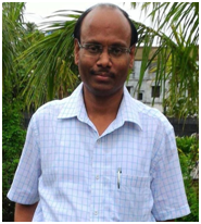
Dr. Ranvir Singh was born and raised in a village in the Sonepat district of Haryana State, India. He recognized the role and importance of water in agriculture as well as the livelihoods in rural landscapes. He studied a Masters in Soil and Water Conservation Engineering from CCS Haryana Agricultural University, Hisar (India) and a PhD in Environmental Sciences from Wageningen University in The Netherlands. He has worked in USA and Australia, and since 2010 he has been working as a Senior Lecturer in Environmental Hydrology and Soil Science at Massey University in New Zealand. Dr. Singh has gained significant knowledge and experience while working on different projects related to water management at different scales in India, USA, Australia and New Zealand. He specializes in agricultural water management, particularly in advances in irrigation systems and computer simulation models to assess and improve water use and its management in agriculture.

Nanotechnology for Water Treatment

Jack Schubert
Murdoch University, Australia

Introduction: In India thousands of people rely on the Ganges and other rivers to carry out daily tasks such as bathing and washing their clothes. As a consequence, an abundance of hazardous contaminants are leeched into waterways each day. Nanoparticles have been shown to be effective in removing a range of contaminants from water sources. Hydroxyapatite (HAP) is a naturally occurring ceramic that can be easily synthesized in nano form. Its applications to date have been mainly in biomedicine due to the similarities it shares with human bone mineral.

Aim: To determine whether there might be a role for nanotechnology in improving water quality in rivers in India.

Method: As part of a New Colombo Plan mobility experience, Murdoch University students worked with colleagues at the biotechnology labs of KIIT University in Bhubaneswar, India, to test whether hydroxyapatite may be effective in removing contaminants from water samples. A sample of water containing malachite green was mixed with powdered nano HAP and centrifuged. Each hour a 1mL aliquot was taken from the sample to undergo spectrophotometry in order to determine how much of the malachite green had been broken down by the nano HAP.

Results: We found that nano HAP, synthesized from cuttlefish bone, was more effective than traditional methods for removing malachite green from water samples. Malachite green is a common synthetic dye used to colour materials such as silk and leather. It poses a significant threat to the environment and to humans if consumed.

Conclusion: The ability of nano HAP to remove malachite green from contaminated water points to the potential for larger scale nanofiltration to play an important role in improving water quality in water ways throughout India. Further study into the efficacy of other nanoparticles in removing specific contaminants will be required.

About the author

Jack Schubert is a 20 year old student from Perth, Western Australia. He studies a Bachelor of Science majoring in physics and nanotechnology as well as a Bachelor of Engineering (Hons) majoring in electrical power & industrial computer systems at Murdoch University. In his second year at university he received the Physics and Nanotechnology staff prize at Murdoch University for achieving the highest grade overall in his second year of study. In the summer of 2016 he and a group of other students received a New Colombo Plan mobility grant which enabled them to travel to Bhubaneswar, India to work in the biotechnology labs of KIIT University working with nanoparticles. After, and hopefully during his tertiary education Jack wishes to establish connections with India to allow him to work and collaborate with people in engineering and science.

Monitoring River Ecosystems Through Citizen Science and Digital Tools

Dr. Pradeep Mehta, Surbhi Sharma, Surabhi Bhardwaj, Pranab J. Patar and Raghuvansh Saxena
Earthwatch Institute India

River ecosystems are affected by anthropogenic activities in many countries. The destruction of natural habitats and the presence of environmental pollutants may affect the ecological balance of every ecosystem (Begon, et. al., 2009). Most importantly, the available water and related aquatic ecosystems are seriously degraded, with almost 70 per cent of its surface water resources contaminated by organic or inorganic pollutants (Kumar and Murty, 2011). Among various ecosystems in the world, rivers which cross different areas such as agriculture and industry are the most threatened and affected by anthropogenic activities (Leprieur, et. al, 2008). Therefore, water monitoring of rivers is of great importance. The measurement of physicochemical parameters is usually time-consuming, cost-intensive and needs special instruments.

Citizen Science promises to bring a fresh perspective to strengthen the environment conservation efforts. It has the potential to bring youth and science together at the field level and empower them with knowledge, understanding and conviction to build conservation movements at the local level. Data and other information generated through citizen science projects have been shown to be reliable and accurate. There is evidence that data from citizen science research projects are increasingly accepted in the academic literature (UNEP, 2014).

Earthwatch Institute India brings together institutions and individuals to understand and inform critical urban freshwater issues by combining scientific field research with experimental learning programmes that inspires to create leaders among citizens. The freshwater watch programme aims at inspiring citizens to value water resources, understand the local freshwater challenge and take proactive action for water conservation and management. This model can help scientists to do long term monitoring of rivers to influence policy decisions. Mobile applications can plan an important role in bridging the gap between citizens and scientists by crowd sourcing of the data.

About the author

Dr. Pradeep Mehta is doctorate from Kumaun University and done management from Maastricht School of Management, The Netherlands is Research & Programme Manager at Earthwatch Institute India. He has 15 years of postdoctoral experience in natural resource management and sustainable livelihoods (mainly agriculture) in the western Himalayan areas of Uttarakhand and Ladakh. Before joining Earthwatch, he worked as a country representative of India at Appropriate Technology Asia. He is member of IUCN Commission on Environment Communication (CEC), Commission on Ecosystem Management (CEM) and Commission on Protected Areas. He is also member of Global Citizen Science Association

Modelling a part of Baitarani Sub-Basin using river system approach through source software

Rabindra Nath Sankhua, Rajendra Kumar Jain, Sandeep Bisht and Shikha Deep
Central Water Commission, India

The Baitarani river sub-basin water planning and allocation is a critical issue, especially with multiple inherently complex systems with many interdependent components. The sustainability of future economic growth and environmental health in the sub-basin depends on the rational allocation of water among the sectors. Scenario analysis coupled with process models greatly enhanced our ability to analyze benefits related to decision making involving the sustainable use and conservation of our ecosystems and the goods and services they provide. The spatial dynamics of water scarcity give rise to various issues that are important in estimating the future water needs. The environmental water demand or environmental flow requirement (EFR) of sub-basin has been attracting increasing attention. Substantial room exists for the improvement of productivity.

This paper presents a river system modelling approach integrated with scenario analysis for the Baitarani river sub-basin. The implementation applies a rainfall-runoff model, the GR4J model, as implemented in the Source software with a river system model, including water demands, basin infrastructure, river operating rules and crop models. The proposed use of the river system model is in exploring participatory and cost-effective ways of introducing better water governance in the Baitarani sub-basin. The study has evaluated the effects of future scenarios that describe varying degrees of development. The model examines the situation of water within the sub-basin for the years 2015, 2021 and 2051. Seven possible future scenarios are analysed along with a baseline scenario.

About the author

Dr. R. N. Sankhua is presently working as Director, Basin Planning Directorate in Central Water Commission, the apex organisation in water resources under Ministry of Water Resources , River Development and Ganga Rejuvenation, Government of India. He has a vast experience in water resources sector particularly related to modelling. He has a number of papers and books published under his name- Practical GIS in Water Resources, MATLAB for Engineers, Statistical Analysis in WR and Fun with Advanced MATLAB are some of the books worthy to mention. He has delivered lectures on GIS and RS application projects and other advanced topics in water resources and also guided number of PhD and Mtech students.

Tuesday 13 September
10:30 – 12:00

A framework for Ecological Transformation of Musi River through Geodesign

Ajitkumar Babar and Sarat Chandra Bokka (presenter)
ESRI India Technologies, India

Musi River is a tributary of the Krishna River in the Deccan Plateau, which originates in Anantagiri Hills near Vikarabad, flowing through Telangana state in India and historical city of the state Hyderabad stands on its banks. Musi River being the lifeline of Hyderabad, is being neglected during city’s development in the recent past. This turned Musi into a drainage carrying wastes from urban and industrial areas of Hyderabad and making the river water downstream remains highly polluted, which has adversely impacted the river ecology. The initiatives taken to clean it are inadequate with aggressive development of the city. A framework integrating design workflows, geography and Geographic information system (GIS) helps in studying and arriving at solution for complex systems and the process is called Geodesign. Geodesign is a way of thinking in finding solutions for complicated spatial problems which helps designers, planners and stakeholder make better informed decisions. The framework of Geodesign provides multiple scenarios, from scenario to scenario giving level of priority to every geographical and non-geographical elements provide results for the decisions made. This provides us impact that a scenario creates by its implementation in design. The framework helps in making scenarios to go through multiple iterations of design and evaluation process, by reducing the time and complexity in performing iterations compared to the traditional methods.

About the author

Ajitkumar Babar is currently working as an Analyst in ESRI India Technologies for the past two years. He perceived his BA in Geography from SP College, Pune and MA in Geography with specialization in Geomorphology from Pune University. He acquired M. Tech in GIS from NIIT University, Rajasthan. During his current work he has been involved with customers from various domain and helping them in implementation of GIS in their workflows. He is deeply interested in fluvial geomorphological research and studying the dynamics of the river ecosystem using GIS.

Hydromorphological walkover survey of 5500km of Scottish Rivers: lessons and opportunities

Sally German, Katie Atkinson, Irantzu Lexartza and David Hetherington
Arup, UK

Much information on river morphology and condition can be collected over long distances using large-scale remote sensing data. However, first-hand findings resulting from walkover surveys by qualified fluvial geomorphologists will always provide more accurate and reliable information. Typically, surveys tend to be done at the reach or waterbody scale over distances of tens of kilometres and pose a range of challenges to overcome including surveyor bias, data quality assurance, logistical complexity, data transfer and storage and practical issues such as weather and locational accuracy.

Arup, along with other project partners, have been undertaking hydromorphological surveys over thousands of kilometres across Scotland for the Scottish Environmental Protection Agency (SEPA). This has provided a unique opportunity to develop and refine survey techniques as part of the collection of a vast data set across a wide range of river typologies and conditions.

An Arup-developed GIS application is being employed on the project in order to collect data in the field using hand-held tablet devices. This approach provides numerous data collection benefits, including increased locational accuracy, zero paper use, ease of use in the field, reduced equipment requirements and reduced risk of data loss. Overall, the use of mobile data collection devices and the associated Arup application has improved the speed and accuracy of data collection and processing, and has reduced surveyor bias by continued development of the application specificity (and associated training). The approach has significantly reduced data processing times compared to conventional paper survey techniques due to data being collected digitally in GIS format.

This paper explains the lessons (technical, practical and managerial) that have been learned during this large and challenging project and explains that opportunities that can result from surveys over large distances of river.

About the author

Sally is an Associate Fluvial Geomorphologist at Arup with more than 20 years’ experience of river surveying, geomorphological analysis and river restoration. Sally has much experience of the design and oversight of implementation of river restoration schemes on a wide range of rivers. Sally has a PhD in Fluvial Geomorphology and is a Chartered Water and Environmental Manager, Scientist and Geographer. Sally is a Fellow of the Royal Geographical Society. Pictured: Katie Atkinson

Riverbed Farming Technology adoption by land poor farmers of Tarai districts of Nepal

Hari Gurung and Juerg Merz
HELVETAS Swiss Intercooperation, Nepal

As rivers in Nepal leave the narrow valleys of the hills and enter the plains they spread out covering large tracks of land and deposit silt in large quantities and form dry riverbed.

Riverbeds considered as a negative output of climate change are increasing every year though flash flood. The riverbed is estimated to be 78,000 hectares. These riverbed areas to a limited extent are used for cultivating horticulture crops due to lack of proper technological know-how. However land scarcity is high in Nepal and 33.7% farming families are landless and land poor. Looking at the larger portion of land poor and availability of underused larger riverbed areas, there is tremendous scope to engage them in the riverbed cultivation to improve their income and food security.

HELVETAS Swiss Intercooperation piloted riverbed farming technology for landless and land poor initially with 670 farming households in 2 districts in 2007. After successful results, riverbed farming then promoted in 9 districts and it is in the process to further promoted in the remaining Tarai districts.

In 2014/15, a total of 6219 (49% women) poor and socially excluded households cultivated cucurbit vegetables in 856 hectare riverbed land. The project provided appropriate riverbed farming technology to these farmers. These poor farmers earned meaningful income of NRs 29054 per season. Even though riverbed farming is seasonal farming, earning from it is re-invested in other productive alternatives. Furthermore, it has been experienced that riverbed farming do not have negative environmental impacts rather it has contributed to minimize sand extraction, sand erosion through green coverage and strengthened regeneration of vegetation.

This paper will briefly highlight riverbed farming technology, promotional process, contribution in increased income and food security and environmental concerns.

About the author

From 2003-now Hari has been working with HELVETAS Swiss Intercooperation in the different capacities (Technical coordinator, district program coordinator). He has strengthened technical capacity of local resource persons and collaborating organization’s staff for vegetable, seed and fruit promotional technologies at the riverbed, road corridor and remote areas to increase household income and food security. During 1997-2002, he joined SNV Nepal as natural resource management officer where he was responsible to plan, design, implement and quality monitoring of the natural resources based integrated development program in collaboration with government line agencies. During 1996-1997 he worked as community organization advisor in PLAN International was engaged in uplifting livelihood situation of foster families particularly focusing on child nutrition and their education. 1987-1995 after graduation he has joined Pakhribas Agriculture center and engaged in livestock based economic development program to increase household income and nutrition of the resource farmers.

Managing Nutrients from Sewage Treatment Plant Discharges in to Receiving Waters by Utilising Nutrient Offsets Framework

Partha Susarla
Unitywater, Australia

Unitywater operates 17 sewage treatment plants (STPs), with the treated effluent discharging into coastal river ecological systems. The main river catchments in Unitywater’s service area: Pine River, Caboolture River, Mooloolah Rover, Maroochy River and Burgess Creek. All these rivers flow out to Pacific Ocean.

Sustainable load studies of the receiving waters showed that the contribution of the point source discharges of Total Nitrogen and Total Phosphorous from the STPs ranges between 3-10%, which highlighted that the nutrients from diffused sources is greater than 90%. To meet the growth in the catchment and stringent environmental standards Unitywater has invested nearly $600M to upgrade the STPs in the last seven years. This investments impacts customer charges significantly.

In the next five years Unitywater will be transitioning from providing hard infrastructure solutions to green infrastructure solutions. This will be achieved by rehabilitation and riparian vegetation of riverbanks and stopping erosion of river banks to reduce the nutrients entering the river system. The first project will be implemented on Caboolture River in 2016-17 financial year.

The nutrient offset projects involve three stages:
• Desktop assessment of the condition of the river and it catchment, including modelling
• Geomorphological field assessment of nutrients bound in the sediment and quantifying the benefits of rehabilitation and securing agreement from the regulator
• Implementation of physical works including river bank stabilisation, riparian planting and monitoring for at least three to five years.

The equivalent nutrients removed from entering the river from the rehabilitation works can then be offset against a treatment plant discharge located downstream of the rehabilitation works. In this instance the treatment plant to benefit will be Burpengary Sewage Treatment Plant.

The cost of river rehabilitation works and resulting nutrient reduction is approximately 30% of the cost of upgrading the treatment plant to reduce the same amount of nutrients.

About the author

Partha Susarla is currently working as Strategic Planning Manager at Unitywater. Partha is responsible for treatment services planning, total water cycle planning, demand forecasting and regional planning. Partha is a chartered professional engineer with nearly 27 years experience in planning and delivery of water and sewgae infrastructure in New Zealand and Australia, Partha has worked as a key member of a number of government working groups to formulate policy in the environmental and nutrient management area. Partha is currently a Board Member of South East Queensland Catchments Member Association. He is alo a member for Council Of Mayors of South East Queensland Catchment Action Plans Working group. Partha has a bachelors degree in civil engineering, a masters degree in environmental engineering and an MBA.

Assessing a varying demand scenario using WEAP for Damanganga Project, India

Sanjay Yadav and Minal Jariwala
Sardar Vallabhai National Institute of Technology, India

Damanganga reservoir project, located in Gujarat, faces many water- related problems being; acute shortage of drinking water in the downstream area, repeated floods, poor agricultural practices and decreasing rainfall trend. Decision Support Systems (DSS) can provide effective tools for water allocation, supply and demand analysis. In the present study, the Water Evaluation And Planning (WEAP) model was used to predict water demand of Damanganga project. WEAP model was calibrated and used to simulate the present condition and predict water demand for three districts. The demand is predicted using population growth rate. Data was entered for demand sites for the base year 2014. The scenario formulated resulted in increase in water demand. The demand is predicted for the year 2021. The reservoir is able to supply increasing demand for full reservoir condition. The development of alternate water resources is mandatory for two out of three districts.

About the author

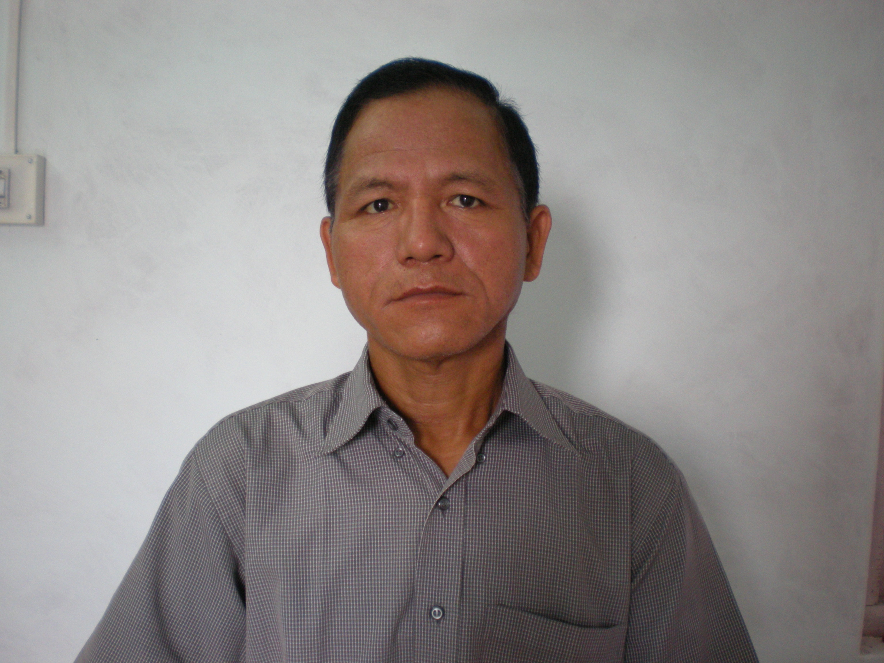
Dr. YADAV S.M. graduated in the year 1987 from B.V.M.Engineering college Vallabh Vidayanagar. He did his masters in Water Resources Engineering from S.V.R College of Engineering and Technology in 1991.He did his Ph.D.(Civil) form Sardar Vallabhbahai National Institute of in the year 2008.He is having teaching experience of 25 years. His areas of research are Fluvial Hydraulics, Water Supply and Drainage Engineering, Irrigation, Ground Water Engineering and Construction management. He has published nearly 100 national and international conference papers and 15 national and international journal papers. He is a member of more than 10 professional national and international bodies. He is working as a reviewer for many national and international journals such as Journal of Water and Soil, Journal of Hydraulic Engineering, International Journal of Engineering, International Journal of Water and Protection, Korean Society of Civil Engineering, etc. Presently he is working as Dean(Alumni and Resource Generation).

About the author

Dr. YADAV S.M. graduated in the year 1987 from B.V.M.Engineering college Vallabh Vidayanagar. He did his masters in Water Resources Engineering from S.V.R College of Engineering and Technology in 1991.He did his Ph.D.(Civil) form Sardar Vallabhbahai National Institute of in the year 2008. He has teaching experience of 25 years. His areas of research are Fluvial Hydraulics, Water Supply and Drainage Engineering, Irrigation, Ground Water Engineering and Construction management. He has published nearly 100 national and international conference papers and 15 national and international journal papers. He is a member of more than 10 professional national and international bodies. He is working as a reviewer for many national and international journals such as Journal of Water and Soil, Journal of Hydraulic Engineering, International Journal of Engineering, International Journal of Water and Protection, Korean Society of Civil Engineering, etc. Presently he is working as Dean (Alumni and Resource Generation).